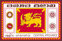
Central Province (Central Province)
 |
The cities of Matale and Nuwara Eliya are in the Central Province. The province is famous for its production of Ceylon tea, planted by the British in the 1860s after a devastating disease killed all the coffee plantations in the province. The Central Province attracts many tourists, with hill station towns such as Gampola, Hatton and Nuwara Eliya.
Though three successive European powers invaded Sri Lanka during the 16th to the 19th century, the Central Province maintained its independence until the early 19th century when the British conquered Kandy. The British then established a colonial headman ranking system in 1824, which came into effect in 1832.
* Colonial head mudaliyars
* Sir Christofel de-Silva (1824–1842)
* Don William Gunawardene De-Saram III (1842–1856)
* Sir Hendrick Ekanayake (1856–1860)
* Sir Alexander-James Divakara Mohotti (1860–1888)
* Don Agaris Divakara Mohotti (1888–1924)
The Mudaliyar Office was abolished in 1924 and the last of the colonial headman retired from their positions and gave up the rule to the British officers in 1926. All headman positions were then passed down to the newly elected governor-general of Central Province. This was established in 1929 as a way for the British to directly rule the provinces.
Map - Central Province (Central Province)
Map


Country - Sri_Lanka
 |
 |
| Flag of Sri Lanka | |
Sri Lanka has a population of around 22 million (2020) and is a multinational state, home to diverse cultures, languages, and ethnicities. The Sinhalese are the majority of the nation's population. The Tamils, who are a large minority group, have also played an influential role in the island's history. Other long established groups include the Moors, the Burghers, the Malays, the Chinese, and the indigenous Vedda.
Currency / Language
| ISO | Currency | Symbol | Significant figures |
|---|---|---|---|
| LKR | Sri Lankan rupee | Rs රු or ரூ | 2 |
| ISO | Language |
|---|---|
| EN | English language |
| SI | Sinhala language |
| TA | Tamil language |
